
|
First image report of the new year and to be honest I wasn't expecting to be doing a report for some time however this Winter seems to be periodically producing short-lived transient snow falls which have been photogenic and worthy of sharing. It has been a strange Winter so far, at the time of writing there have been no severe events to date, no 'significant' snowfalls, no blizzards and no broken records and to date we have had only one snow event at ground level which was fairly widespread, the depth of this was shallow or even a dusting which melted soon after it fell. I have yet to experience one decent low level snow event this season or what I would call our typical impressive depths on the mountains. We usually get several of these events every year which tend to be in a minority but this season has been very different.
There has been much talk about SSW and its effects on our Winter for UK, Europe and North America. Signs indicated that many cold outcomes were possible this season which raised our expectations. However a SSW is not a promise of snow and can go the other way so serious model watching has been going on for several months. What the 2020/2021 Winter lacked in severity it has certainly made up for with persistence and regular cold incursions from various directions which have brought short and also medium length cold events. The Atlantic has been tempered and rather quiet which has been unusual which has paved the way for high pressure events and regular Nly, NEly and NWly flows, the upper air has been consistently cold, not overly so, but cold enough to generate snow showers or freezing nights.
What all this means is that we have experienced many cold days and nights and regular but scattered snow events, much more than we normally expect to get so this has been interesting. Between January and early February we have had a selection of nights inland at -5C and with Co. Down at -7C, in fact last night -10C was recorded at Castlederg in the same area which was rather impressive. There have been ice events, many frosts, an abundance of fern frost and even rare hoar frost events, the latter related to me by a sighting from Paul Martin in Omagh. Bizarre and unusual snow flowers or frost flowers have been captured on camera which even made the main evening news. Snow events have been documented, not widespread but regular in areas more prone to such falls like mountainous regions of Donegal, Derry/Londonderry, Tyrone and the Mournes in Co. Down, however the greatest frequency of snow has been in the NW. Low level snow tends to vanish quickly due to temps staying above zero degrees often aided by a bright Winter sun, however the high ground managed to hold onto snow for impressive periods of time. I personally have observed snow on the summits of Moneyneany, Mullaghmore and Sperrins for almost two weeks while the rest of the landscape surrounding these areas was snow-free, this was indicative of just hold cold these regions have been during this period. I haven't seen the hills holding onto snow for as long as this since 2010, 2011 and 2014 so this in itself has been worthy of mentioning.
In conjunction with this Winter weather has been the ongoing threat from Covid-19, we are still in the midst of a global pandemic. For some reason many thought the new year would bring a new start, however I knew this wasn't going to be the case, after all, a virus doesn't respect dates and Human wishes. So when another lock down was announced immediately over Christmas I wasn't surprised in the slightest, I was expecting it. So as it stands we have all been enduring a lot this season, colder weather, restrictions and Covid-19 always threatening us on a daily basis. It has been a challenging time for everyone. This lock down varies greatly in comparison to the first lock down back in Spring 2020, back then it was a new thing and it coincided with hot weather, back to back days of sunshine and long hours of daylight. This made life much easier, in fact, for some it was like a holiday at home. Many indulged in catching rays, working in the garden, exercising or taking up new projects to pass the time, and the heat and light made it so much easier. However lock down in Winter is a different entity, dark days, small daylight hours, miserable grey skies, cold outside, and the January blues and little sign of hope at the start of a new year have really affected the mental health of a lot of people.
I don't know how I wondered off into the realm of lock downs and mental health however it seems to be all that people talk about now and it affects every one of us. There is a weather related reason for this mention however, I have noticed how people's attitudes and mental health have changed when it snowed. The period between January 23rd and 25th in particular presented a beautiful period of postcard Winter weather. Suddenly we lost the grey skies to be replaced by bright Winter sunshine, pristine deep blue 'polar skies' and the white gold covering the countryside. Social media was full of images and selfies of individuals and families enjoying the snow. Many went for walks and hikes, families sleighed down slopes and some even skied on the mountains, it was a very joyous period and the smiles of everyone's faces was infectious in a very positive way. Snow changed the landscape, it was something new and exciting, even those who normally despise the white gold found pleasure in walking in it. Snow lifted everyone's spirits, it brought a childish joy to adults and encouraged exercise and play with exposure to clean frigid air.
This report documents my own adventures during this time period at its most photogenic stage. Despite a lock down with restrictions I managed to get out and do what I do and I was grateful for it after a long period of inactivity. This isn't just a passion for me, it's my livelihood. I'm a self employed photographer who specializes in digital imagery, video footage and time lapse photography of the night sky and weather events so for me this was work. To put it another way, I'm literally penniless and have no income unless I'm out filming new material. From both necessity and passion I decided to make a play on this topical weather subject.
 |
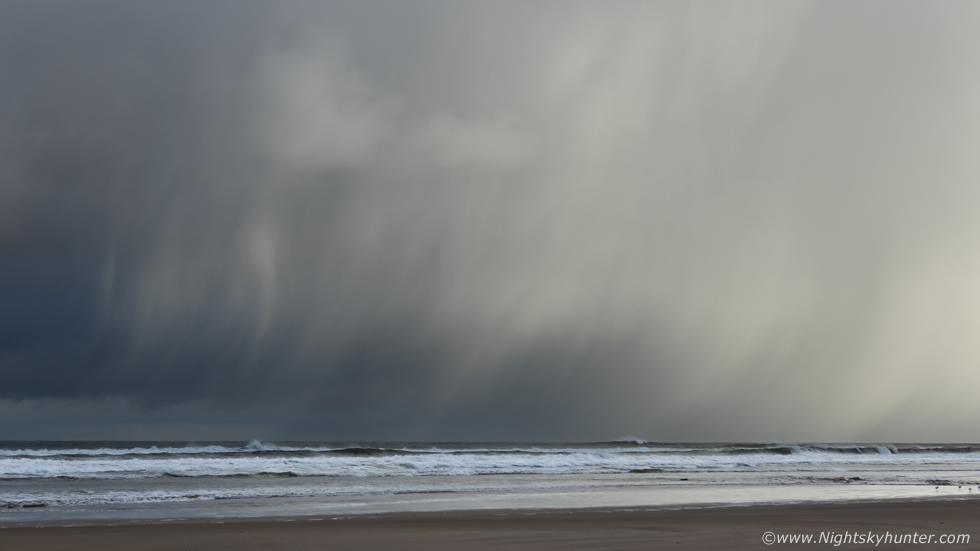
On January 23rd I was on my way to the north coast during the early morning hours. Polar air had been advecting S all night and across the ocean and migrating over inland coastal areas. This frigid air over warmer sea surface temperatures (SSTs) would generate cold air convection. In other words showers of hail, sleet and snow with a slight chance of thunder, in fact, thundersnow wasn't entirely ruled out however the best chance of sporadic lightning would be over the open ocean to the W and NW where the greatest instability was present. That being said with a chance of cells you never ever know what you are going to witness, there was always the chance of dramatic cloudscapes, especially in a clean air mass like this which offered better visibility but of greater interest was the fact that similar air masses have produced funnel clouds and waterspouts here before and its the prospects of these rare events which lure me out.
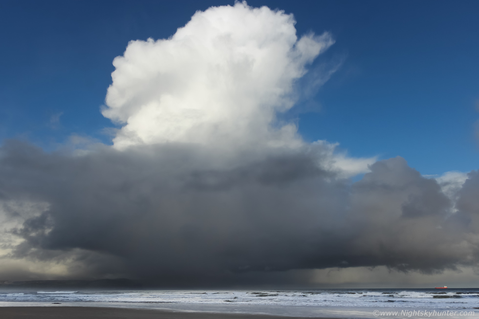
This was the first of three days in a row of stunning weather, one of those classic Winter days which keep you buzzing, the kind which make you feel delighted you are driving in rather than sitting in the house. That morning the sun was up, bright and vibrant, and the blue sky was clean and sublime. I was impressed by the cloudscapes far ahead of me. A massive line of brilliant white crisp towers and Cumulonimbus (Cb) cells extended across the entire skyline from N to NE, all of them were solid and impressive, I hadn't seen hail and snow cell formations like this since 2010 so I was impressed with my first convective experience of 2020. As I drove I watched them develop however they were shifting more to the E and where getting out of range, given the lack of shear aloft I figured they would weaken with time. I never got a single image of this line however I decided to focus on new developments to the N and NW. I didn't have long to wait, two large Cbs were already coming into view over Donegal with more towers ahead, I took the coastal route then pulled into Downhill Beach for a look.
I was rewarded in an instant, to my 9 o'clock position was a huge cell over Lough Foyle with anvil tilting over inland, the base was pure black and nasty and so slow moving in the slack wind that it took one hour to clear the lough. But my attention was drawn to fresh convection, two tidy cells had formed in front of me to the N and NW. This was the NW cell, I took this image while it was in the process from transitioning from Towering Cumulus into a Cb, you can see the surprisingly strong updraught plume in the process of evolving into an anvil. The base was very low to the surface which is something I like to see. The cell was of a respectable size too, if you look to the lower right you can see a red tanker called Sten Arnold for a size comparison, the tanker is 150m in length.
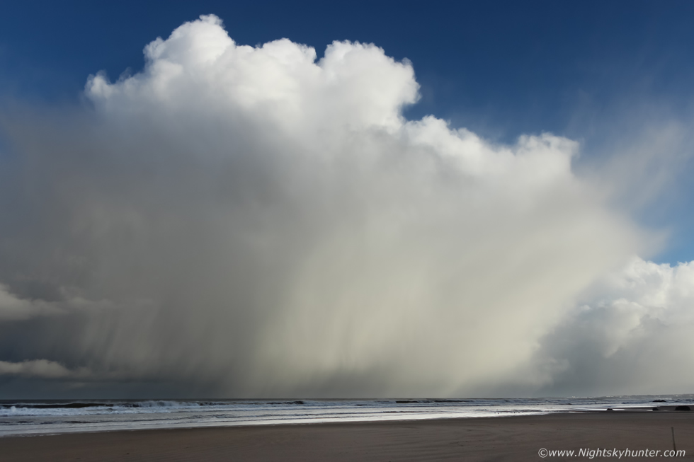 |
This was the lead cell ahead of the one I just captured, facing N, it was moving L to R. This cell was just approaching its mature stage and dropping large curtains of hail stones and wet snow over the ocean. The base behind the core was free from rain below a shallow flanking line so I observed that for a time in case of a surprise funnel.
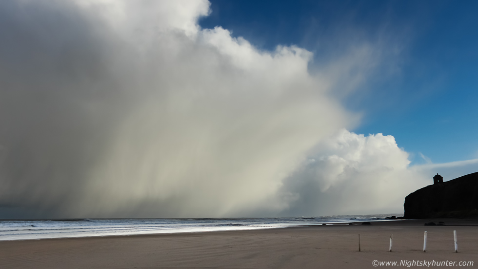 |
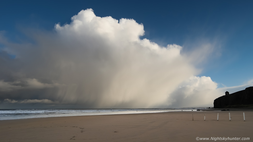
Cell even stronger and looking mean as it trekked closer to the Co. Antrim coastline with Mussenden Temple making for a nice foreground subject. Despite the slow forward motion and lack of shear aloft it was a different story on the beach. The huge black cell over the Foyle behind me was now spent and decaying, its hail-cooled outflow was blasting long the coast as an invisible gust front. The situation on the beach went from calm and pleasant to icy cold wind in the 20-25mph range, it was an utter shock to the system after being indoors for so long.
 |
The interface between the hail/snow core and another cell in front was quite a cool scene, I liked this structure, to be honest it looked more like a Summer convective scene than Winter. This was 55mm, Portrush and Portstewart were getting the goods from the new lead cell.
 |
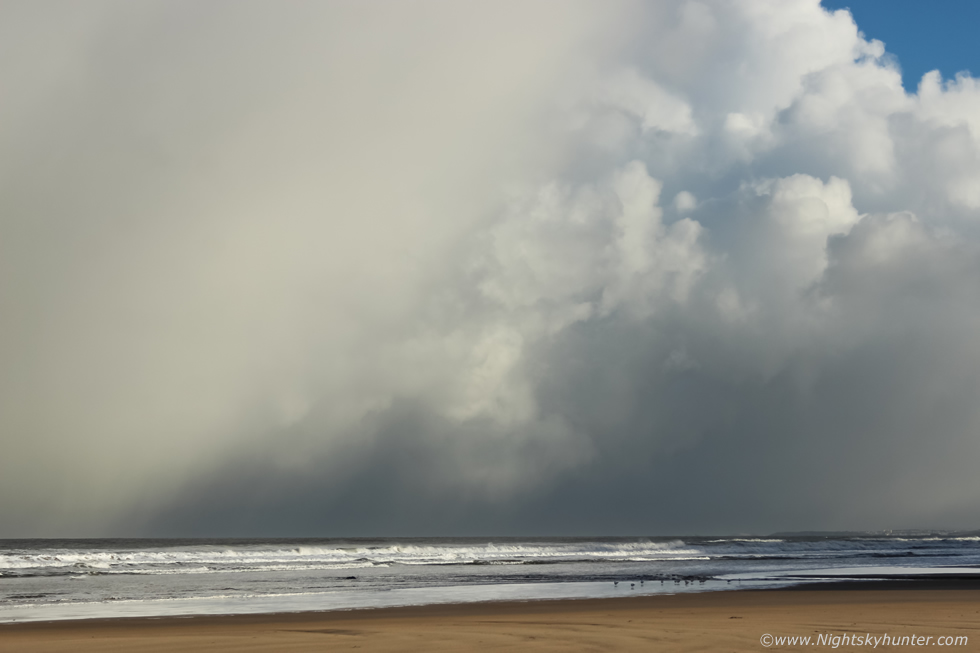
Hard to beat watching graceful curtains of hail and snow falling over the ocean
 |
Super wide angle 15mm on full frame capture of the entire scene. The colour of the deep blue sky really complimented these isolated cells. I felt like I had been treated on my first chase of the year. Over the next couple of hours the CAPE shifted S and weakened with no more structures so these were the best I had seen all day, I was content enough, the cold air would remain over N. Ireland for the next week so there would be more action to come.
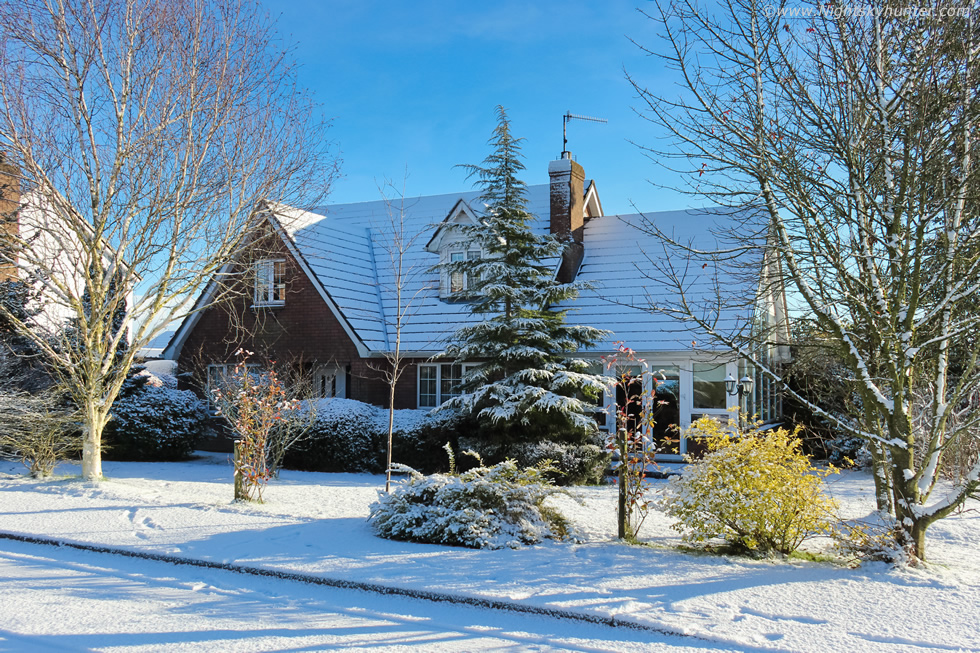 |
On the 24th we had a rare low level snowfall. These don't seem to be happening as often as earlier years so this was much welcomed. Not just in Tyrone but many other areas too. It was really only 1cm-2cm in depth at best but it was beautiful and covered everything. The road had turned to ice covered in snow, the neighbourhood looked like a Winter wonderland. It really is a treat getting snow at home after all the miles usually spent on mountains chasing it at higher elevations. I fully intended on taking advantage of this opportunity, if it was laying here then it had to be better on the hills, I could hear cars spinning and the sound of ice scrapers and shovels, a sound I like to hear. Roisin had finished her home-based work early so we decided to spend the day out filming snow. Roisin hadn't had a nature fix in a long time due to lock down and zoom work commitments so this was a rare chance to get out for a nice day of fresh air, I was delighted to have Roisin along with me for company and as spotter and helper.
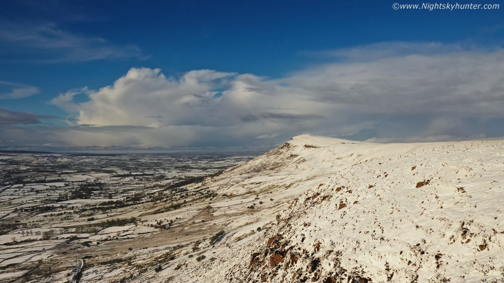 |
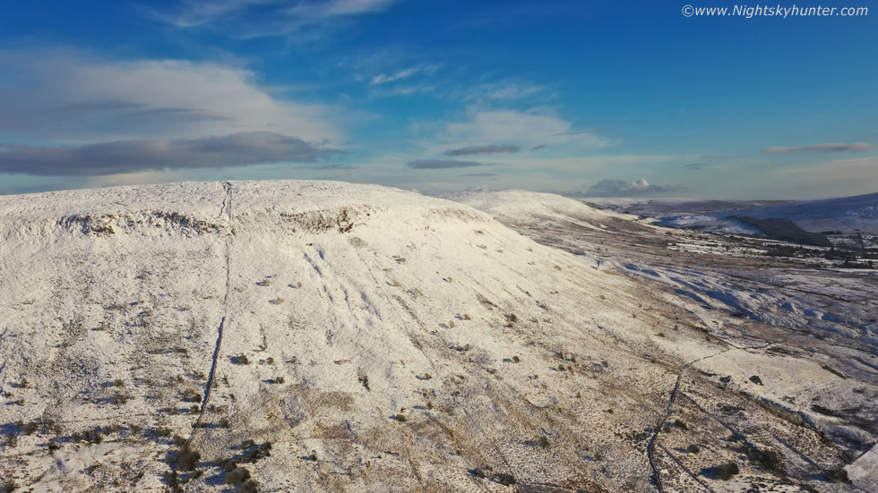
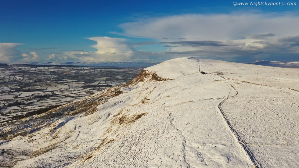
We hit the road on our exciting adventure, there was no plan, just hit higher ground and get a visual on the best snow scenes and make a bee line for those. On the carriageway we were shocked to see that Slieve Gallion only had a patchy dusting, it wasn't worth looking at, and the fields around us which were once covered in snow were now melting at ground level, perhaps the snow showers were more selective than what I had thought. Mullaghmore and Moneyneany had snow however it wasn't exceptional so we made our way to Maghera then Glenshane Pass, stopped for supplies then reached the top of the Pass, the snow wasn't amazing there either so we kept driving. Once we arrived in Dungiven we looked to the right and saw a splendid sight. Benbradagh covered in snow surrounded by blue skies, it was perfect and just what we were looking for. We made it a third of the way up the mountain before the van spun out, then parked and got out for a walk.
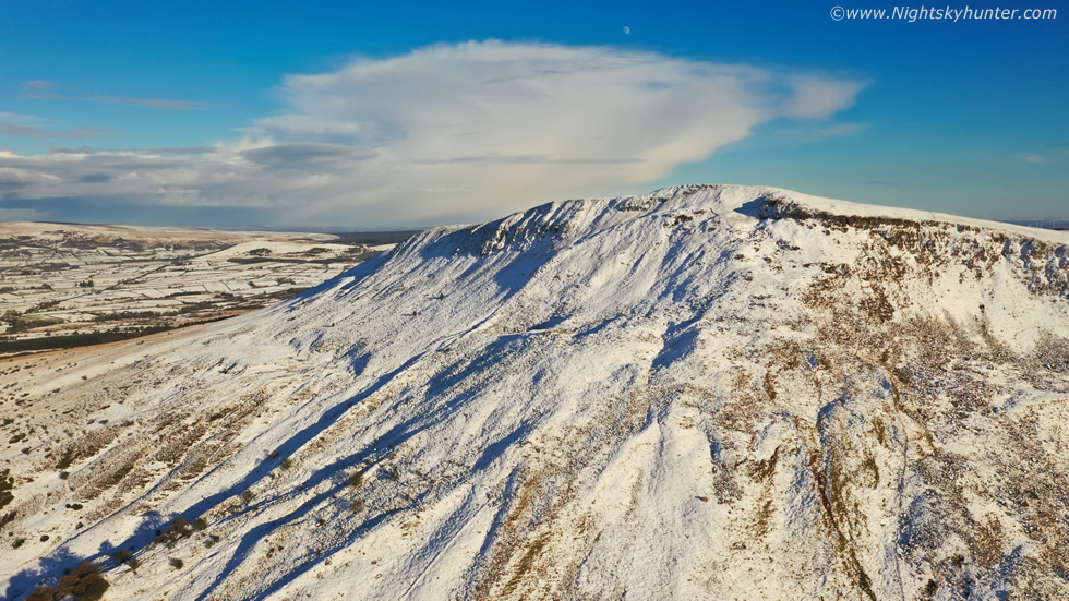
The conditions were perfect, there wasn't a breath of air, the snow was crisp and fresh, it was shockingly cold but it felt pure and clean, and that sky was something else. The depth of the deep blue over the snow was something to behold, there must have been exceptional transparency this day. Looking S I saw a large band of high level cloud slowly approaching ahead of the next front coming in later, the leading edge of the Cirrostratus sheild was ten degrees below the sun, once it passed over it we would loose this wonderful light and blue skies, I wasted no time and got the drone in the air. This was the view with the drone hovering near the E summit facing the W peak. In the distance you make out Lough Foyle then Co. Donegal, above the latter was a cell dropping snow over the landscape, it was quite a beautiful scene. I took a small number of aerial stills and panoramas however for the most part I shot video.
 |
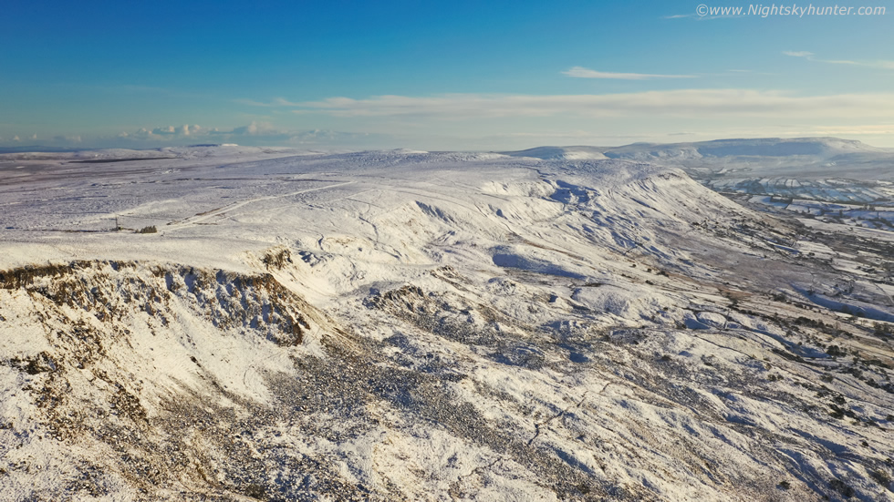
Not far from the same hovering position, rotating the drone 180 degrees to capture the E summit. I obtained nice footage with the drone low to the mountain as it flew over snow-covered rocks and trees as the Mavic 2 Pro ascended the mountain. Roisin and I had a great walk up the steep gradient in the snow, it truly was invigorating. After our exercise we decided to call it a day, the prospect of getting back to a warm house and home made dinner was very appealing and we had worked up an appetite.
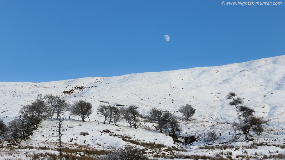 |
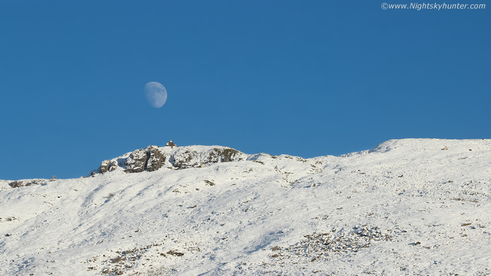
We where in the car, engine running and about to drive off, when I glanced over my shoulder and spotted the moon rising over the summit, I jumped out and attached the 100-400mm lens and began running back up the hill to get a good vantage point and line of sight so the moon was as close to the top as possible, this was at 100mm.
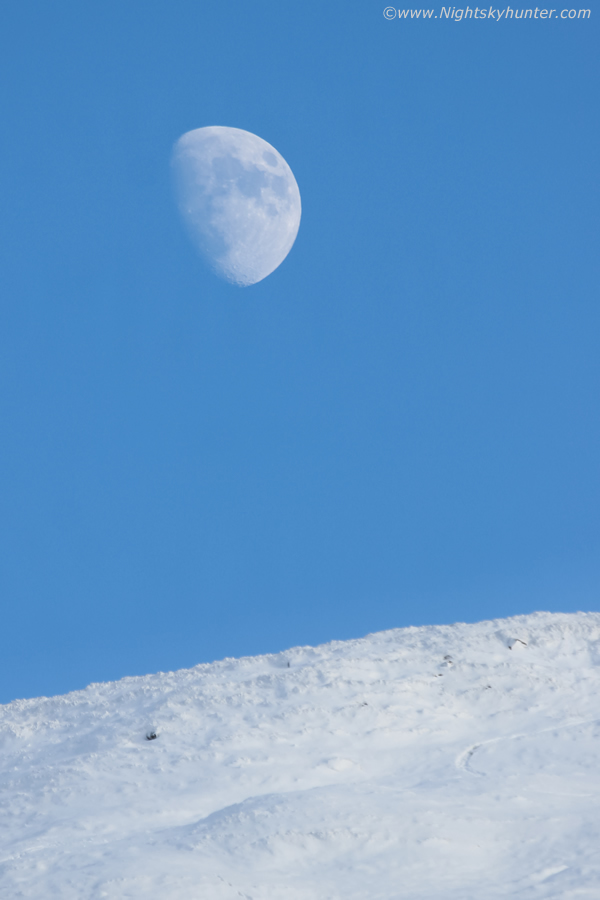 |
400mm portrait version and slightly cropped. It's not often I see the waxing gibbous moon rising in the daytime sky over a snow capped mountain in this country. Interesting scene for what it could convey, there's now circumstantial evidence that there could be frozen water ice inside certain craters on the moon.
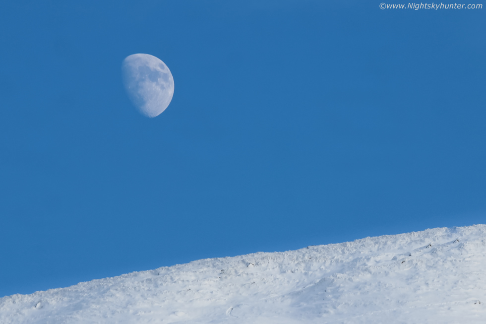 |
Uncropped 400mm view, this scene made for a great finale to this day's shoot. Roisin and I took a detour on the way back and decided to check out the Birren road, it was entirely white before we even got there but we didn't even make it to the top of the first hill. The temperature was reading -1C at 15.00 UT and we were driving on ice covered in snow. The wheels couldn't get traction and hence I couldn't get the speed and momentum I needed to reach the top so we spun out. We reversed back, the van did a controlled 180 degree slide downhill then we retreated back home for dinner.
 |
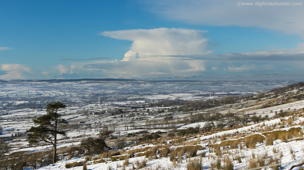
The next day was just as sublime as the previous. There had been over night snow in places to the S however no more over the Sperrins but with freezing temperatures overnight the odds were high that snow would still be laying on the mountains. Yet again the light was perfect with bright sunshine, no wind and deep blue skies, it was time for more filming. Roisin and I headed back to Benbradagh, we did a walk up the steep incline once more and this time I managed to walk much farther and at a faster pace while carrying a ruck sack with DSLR gear and drone kit bag, I was already feeling much fitter than the day before. The view from that mountain road was gorgeous with flat horizon to the W and SW and to the E the snow covered summit shone vividly against that wonderful clean sky.
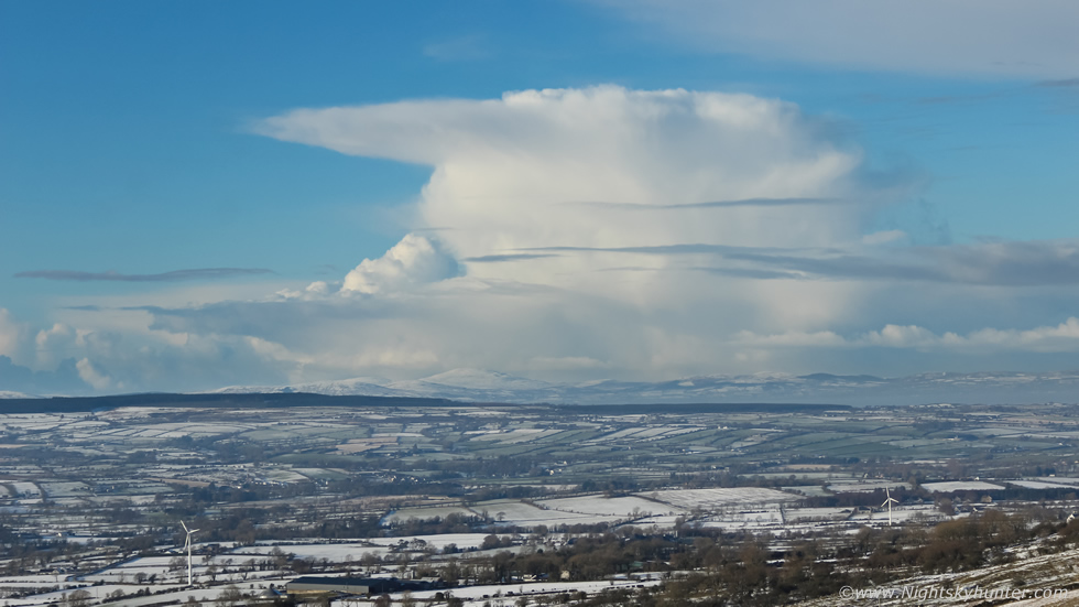
I got the drone in the air once more, first flying low over the flank, passing rocks, bushes and Sheep then climbing to the top for a birds eye perspective. Once again convective cells graced the W and NW skyline with numerous Cbs in various stages of development over Co. Donegal. The bigger cell to the R is in the process of decaying, you can tell by its unorganized flimsy form with diffuse outline suggestive of a spent cell. However the fresh cell to its L looked much better with a more solid profile and new anvil forming, there's even a slight over shooting top. You can tell that these anvils are symmetrical indicative of no upper level support, by which I mean lack of strong shear so these cells are of the pulse variety with short life spans of 20-40 min's. Shear or no shear they were still beautiful to watch as they dominated the skyline over a snowy foreground. While filming video from this height I was slowly moving the drone towards that distant summit, I saw a dark outline there but in the wide FOV I couldn't make it out, I assumed it was a solitary tree, then as I got closer I was surprised to see it was a person standing near the edge taking in the view, check out the footage below to see that moment.
 |
Looking S/SE towards the other summit and in the distance the Sperrins with Mullaghmore. I have many fond Winter memories of Benbradagh, this place has always been good to me. I have experienced great thunderstorms from here, several funnel clouds and absolutely beautiful snowfalls, some of which were massive and impassable. Just like the guy on the summit I used to hike alone to the very top in deep snow carrying all my camera gear and tripod just to get an image and take in the view, the hike up was great but going back down was always a challenge. The mountain pulls you down as you build up momentum in your stride which increases you chance of a slip on ice and an injury so one has to be careful. At sunset the temperature drops alarmingly at this altitude, I recall one time being utterly frozen during a descent in deep snow, the cold and wind chill had killed my hands, they hurt so much and I couldn't carry my tripod, I was yelling out loud with discomfort and the cold felt like it was freezing the inside of my lungs, but I made it and when I got back in the van it felt like such a great experience.
 |
As Roisin and I began our walk down we stopped to admire the convection just as a family passed us in a sleigh, they had stopped to admire my drone which was still hovering aloft. I grabbed the DSLR for a few stills, this is that came Cb over Donegal at 32mm.
 |
Zoomed into 55mm, you can see strands of snow falling from aloft and along the side of the cell. The mountains below look very well coated, from what I saw online Donegal got the best snow in the country this day.
 |
I re-positioned the drone and captured this view looking back on the summit. It was a grand spectacle to end the day with Cb anvil in the distance and rising moon all in the same shot.
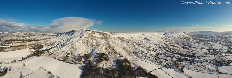 |
180 degree panorama of the same scene, the drone takes ten 20MP images and stitches them together onboard the aircraft within a few seconds, this was the end result. All of Benbradagh with anvil, moon, snow and polar blue sky all in the same image. This image is only 980 pixels wide which doesn't do the scene justice. The actual image is 6676 x 2246 so the scale is massive and the detail impressive. Unfortunately I can't share a larger version of these panoramas online due to the risk of image theft.
 |
We were actually driving down the mountain heading home when for the second day in a row I spotted the waxing gibbous moon in the daytime sky rising over the summit, we stopped, it was worth another image so I got the 100-400mm back out. Even though snow happens every year in N. Ireland and our mountain areas can be prone to snow and even though I have captured moonlit snow on many nights I don't actually think I have a single image of the daytime moon rising over a snow scene, I did get that yesterday but it was worthy of another go.
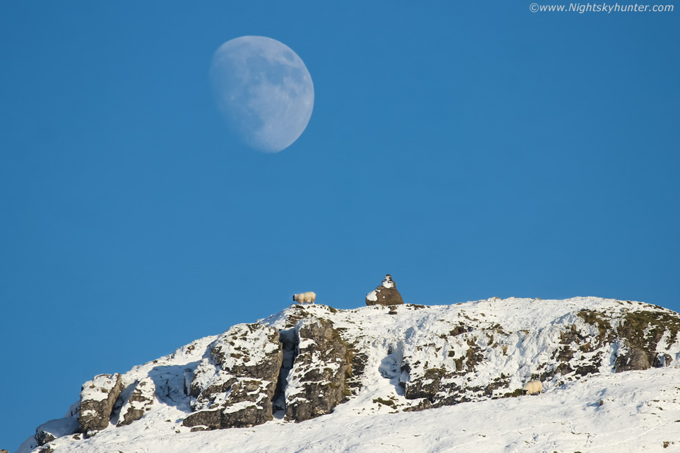 |
Zooming into 400mm and slight crop revealed a perfectly placed Sheep on the very top of the summit with the moon above, the large dark marks on the lunar surface dominating the right side are the famous 'Maria' or lunar seas, these are actually impact basins from ancient comet and asteroid strikes mostly formed during the period of the late heavy bombardment, the basins then filled in with lava and molten rock and cooled into what we see today. On view is Marie Crisium, Marie Tranquillitatis, Marie Serenitatis and Marie Nectaris.
Aerial footage from day one at Benbradagh showing the low flight revealing the E then W summits, those distant Cbs, and you can see Roisin waving at the end.
Drone footage from day two of the W summit and the flight over the man standing there whom I had mistook for a tree, then endind with a backwards reveal of the mountain with anvil and moon during the last light of day. These last few days were immensely enjoyable, there's no better sensation than a nature fix, especially in the snow. As I write this report on February 1st the Winter is still young despite Spring being on the horizon. The models are indicating yet another cold spell and we often get our finest Winter action during February, March and sometimes even April so I'm confident there will be more Winter filming sessions to come this season. For the moment, this is my first image report of 2021, I hope you enjoyed it and I will see you all on the next one, thanks for reading.
Martin McKenna
